High-Resolution Aerial Mapping and 3D Documentation for Conservation and Cultural Preservation
WAIHE‘E COASTAL DUNES & WETLANDS REFUGE
Ortho Map
For the Waiheʻe Wetlands site, we produced a high-resolution aerial orthomosaic to accurately document surface conditions across the property. Using professional drone mapping and photogrammetry workflows, the imagery was processed into a geospatially accurate map suitable for planning, conservation, and site assessment. The final deliverable provides clear visual detail while maintaining precise spatial alignment, making it useful for environmental review, land management, and future project planning at Hawaiʻi Land Trust
WAIHE‘E COASTAl HEIAU
3D Site Documentation
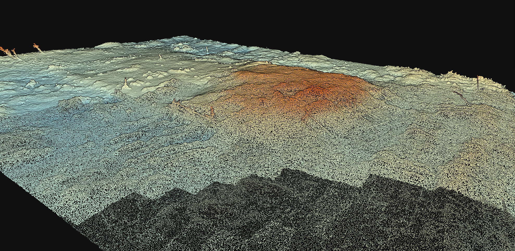
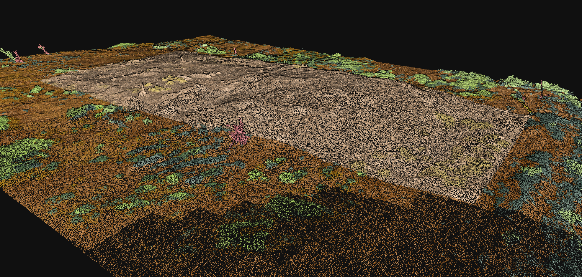
For the Waiheʻe site, ʻImi Systems conducted a non-invasive aerial photogrammetry survey of Kealakaʻihonua Heiau to produce a high-resolution 3D model of the historic structure. All data was captured exclusively from above, with no ground contact or site disturbance, ensuring the protection of this culturally significant wahi pana. The resulting 3D model accurately documents surface features, form, and spatial relationships, providing Hawaiʻi Land Trust with a detailed digital record to support cultural preservation, visualization, and long-term stewardship planning.
Elevation & Surface Analytics
Derived from high-resolution aerial photogrammetry, these elevation and surface classification maps provide analytical insight into terrain variation and land cover distribution, supporting data-driven environmental assessment, modeling, and long-term land management decisions.
Bring Conservation-Grade Mapping to Your Site
From conservation areas to culturally significant sites, ʻImi Systems applies non-invasive drone mapping and analytics to support responsible land use across Maui